
 |
LIFETIME of WALKS by DEREK HARWOODDerek Harwood's Walking Records If you have any queries about the pictures or discriptions e-mail me at: derek@harwoodonline.com | ||||
 | |||||
| 'AA' - NO THROUGH ROAD - WALK GREAT GABLE - No. 150 Tuesday 8th June 2004 ................................Walk No. 585 |
 | ||||
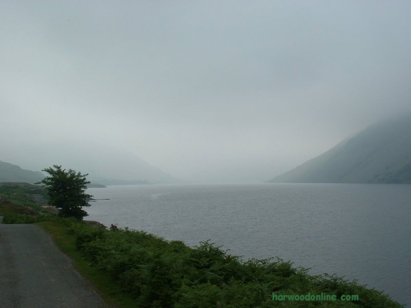
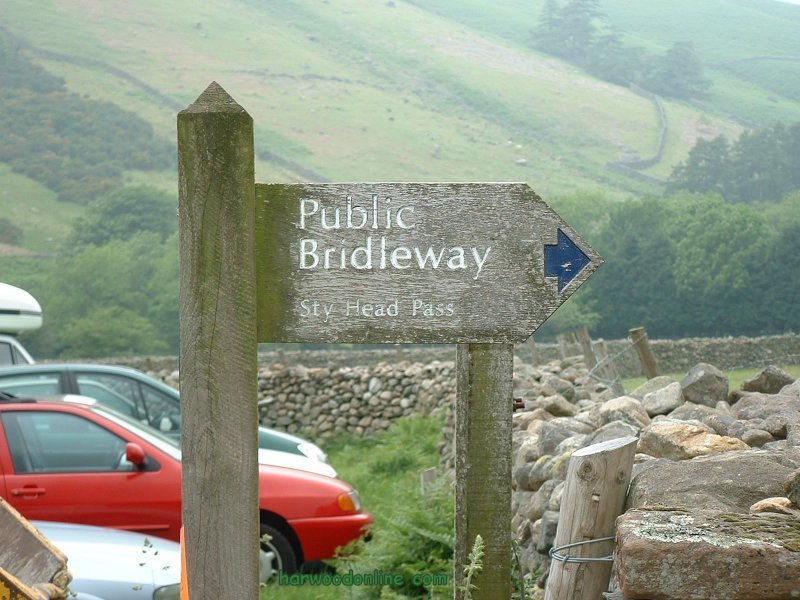
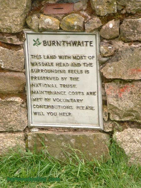
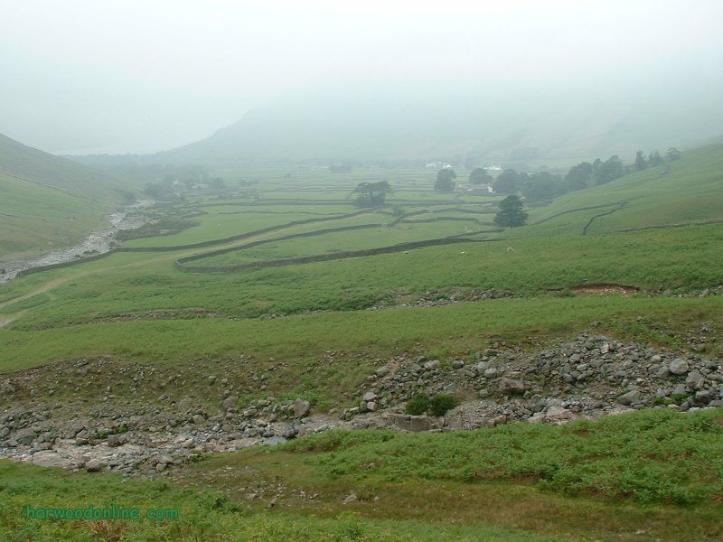
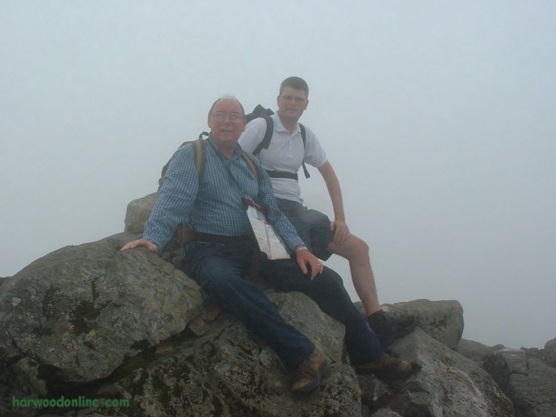
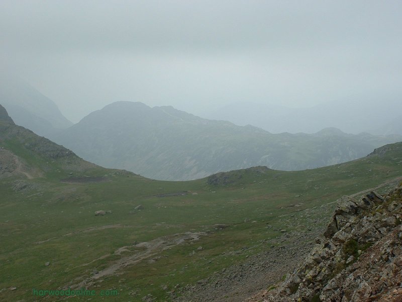
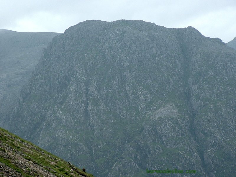
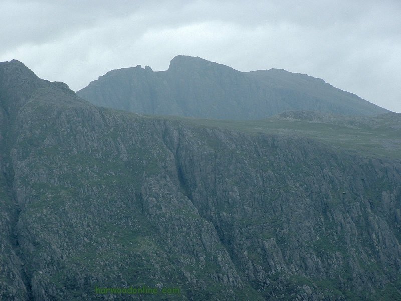
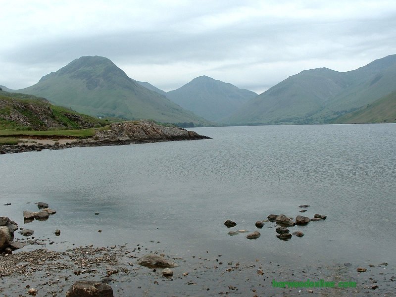
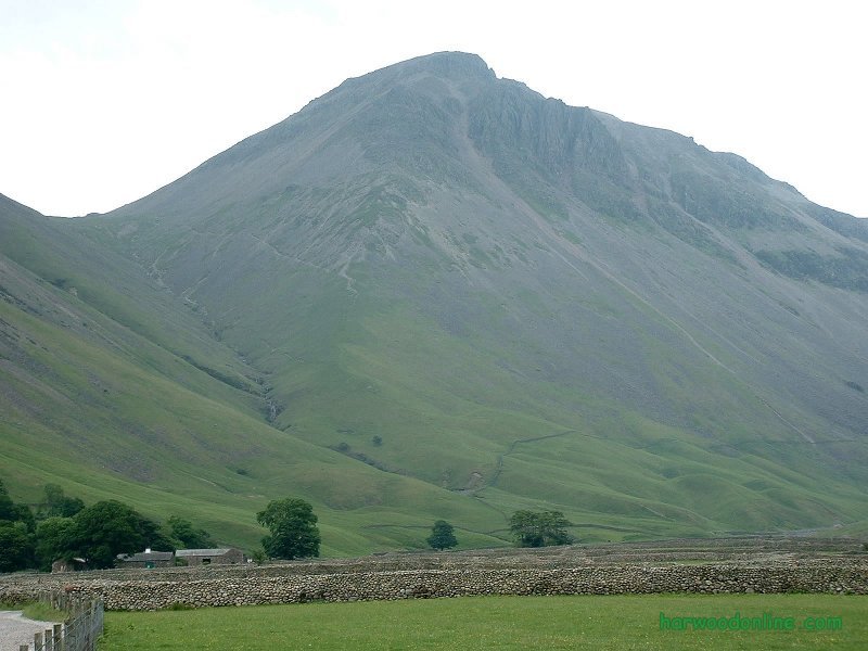
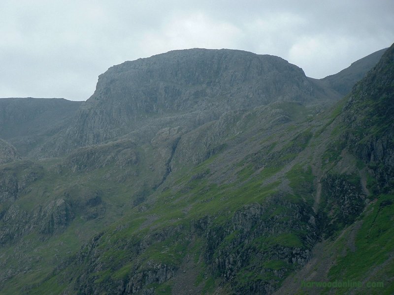
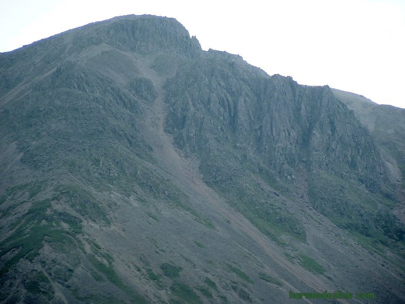
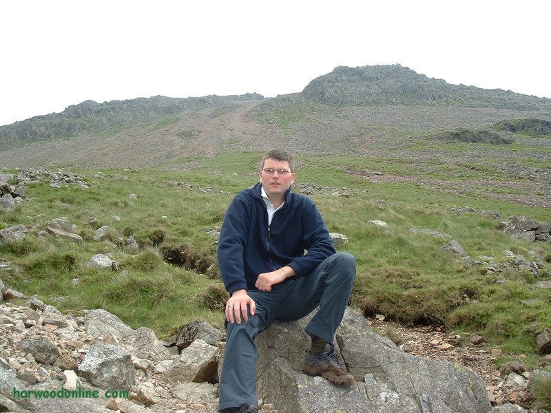
'AA' No Through Road  No. 180           Total 785.5 miles

Time Taken:  5.25 hrs   Distance:   Enjoyment:    Weather:   Very Low Cloud
 11:30 am - 4:45 pm       5 miles           90%        Chilly on Top, Brighter at Finish

Temp:     Cloud:     Rain:    Visibility:      Ground Conditions:    Wild Life:
  18oC       100%        2%         Mist              Good Underfoot             Sheep

Total AA:    Total MH:   Total LD:    Total AW:     Other:    Total Distance:
 785.5 mls       808 mls    1700.5 mls     121 mls      898 mls      4313 miles

Companions:   (Derek)   Phillip Moore

Points of Interest:
Wasdale Head            Burnthwaight           Moses' Trod           Lingmell Beck
Gable Beck                Gravel Neese             Kirk Fell               Beck Head
Great Napes              White Napes      Westmoreland Cairn       Great End
Sty Head                     Piers Gill                Lingmell                The Scafells

GREAT GABLE   2949 Feet (899 Metres)
General: 163 of 205 'AA' Walks completed. 'AA' No Through Road, 180th walk & 785.5 miles. Parked in 'Wasdale Head' National Trust Car Park at 11:30am. We were surprised car park was not even half full. Walked along lane towards Sty Head and Burnthwaite. Crossed bridge over Gable Beck where beck meets Lingmell Beck. Turned left up Moses' Trod and into mist. Turned off ridge path and along path by Gable Beck to ensure we had a good reference point in the mist. Continued in mist with beck on left to col with Kirk Fell at Beck Head. Lost path in mist near col because we passed the source of the beck. Large rocks looked like sheep the visibility was so bad. Continued with slope & height to right until path found from Kirk Fell. This faint path eventually joined the better track ascending Great Gable from Honister Pass. Met a couple resting who had walked from Honister Pass. We asked if we were on Great Gable and they admitted they had discussed saying they were on Kirk Fell. Arrived at summit at 2:10pm, surprised not to see other walkers. A father and two sons soon arrived who were obviously keen walkers. He confirmed that we were on the summit and took photos of us. By the time we left the summit there were several groups of walkers around eating their sandwiches. I took a compass bearing and looked for the good path to Sly Head. We had difficulty finding a good path in the mist but eventually descended very steeply down and between crags. The steepness of the path did not relent and soon became very loose. We carefully slid down the mountainside in the mist, very slowly at first then more quickly as we gained confidence. All under control except for one bad moment when I changed my leading leg and went flying. Phil came to my rescue and we came to a slow halt. We eventually saw the col at the bottom of the slope through the mist, and assumed it was Sty Head. However as we continued and the mist lifted a lake could be seen to the left. I knew immediately we were wrong, but where were we? Then I realised we were descending a scree back down to Gable Beck. We had long past the point of no return, so we continued down to the beck and looked up at the now clear mountain and the huge scree with the White Napes Crag on the right. By this time all the surrounding mountains were clear of mist, including Scafell Pike. We wished we had waited longer on the summit, enjoyed the view and descended by the correct path to Sty Head. We strolled back to the car feeling our 'Scree' muscles starting to ache. We arrived back at the car by 4.45pm, with a panoramic view of mountains. What an eventful day, with so many emotions. www.streepmap.co.uk, start/finish Wasdale Head Car Park 318675/508525, via Westmoreland Cairn 320910/510185. Hazards: Do not walk in mist unless there is no other choice. It is so easy to lose your bearings and walk into danger. Take great care to read the compass and map correctly, especially in mist. | |||||
 | |||||
 | |||||
 | |||||
|
|||||
 | |||||
 | |||||
 | |||||
 | |||||
 | |||||
 |
 |
 |
 |
 | |
| Previous Walk : Next Walk : More Photos : 'Midland Hillwalking' Photos : 'Lake District' Photos | |||||
| News : Formula 1 : Walking : Table Tennis : Bellringing : My Friends : My Guestbook : CV : Links | |||||
Derek Harwood: Copyright 2004 Devised: October 2004 | |||||