
 |
LIFETIME of WALKS by DEREK HARWOODDerek Harwood's Walking Records If you have any queries about the pictures or discriptions e-mail me at: derek@harwoodonline.com | ||||
 | |||||
| LAKE DISTRICT WALK OLD MAN OF CONISTON Friday 2nd July 2004 ...............Walk No. 588 |
 | ||||
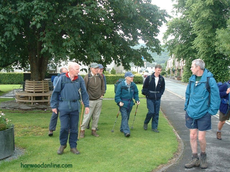
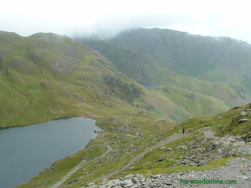
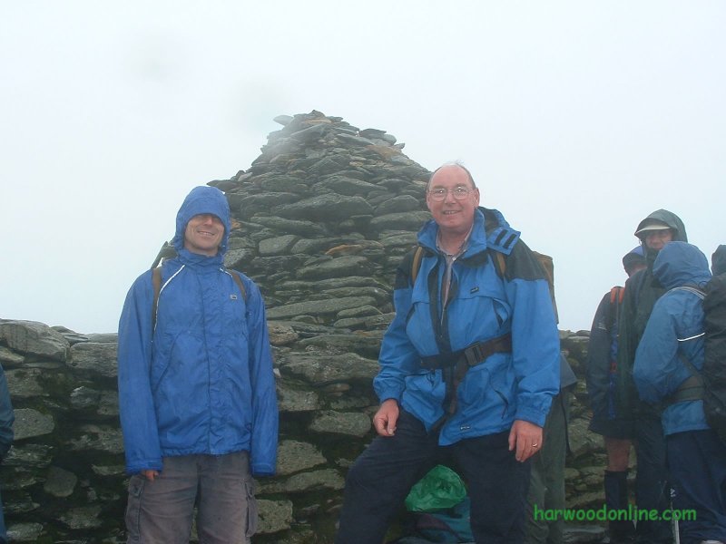
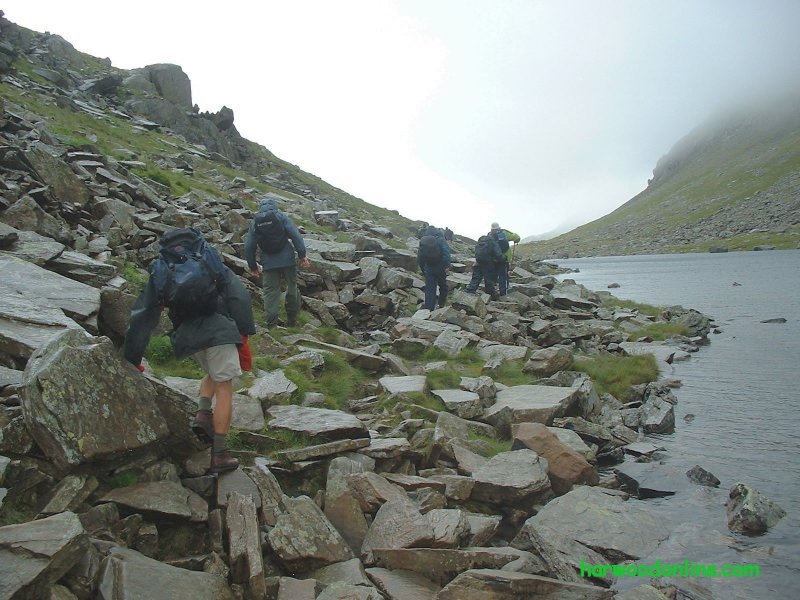
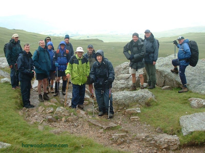
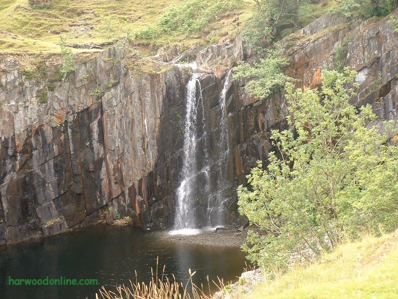
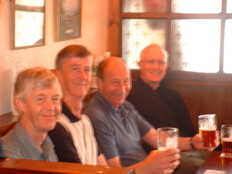
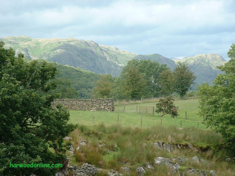
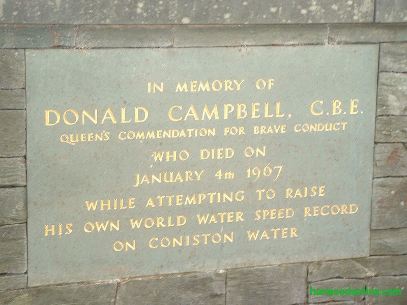
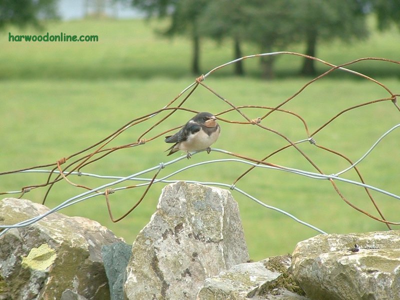
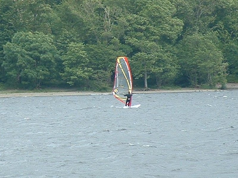
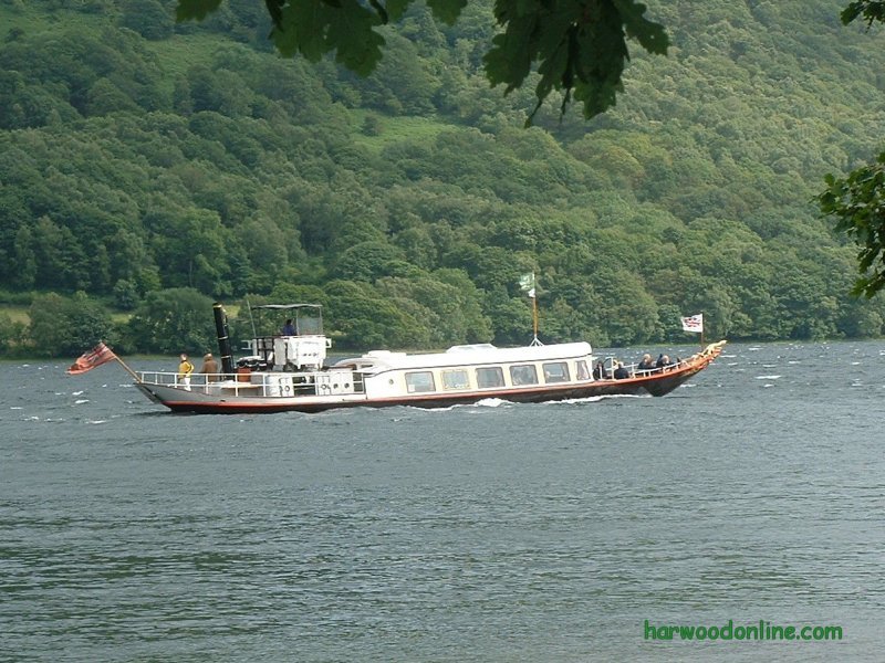
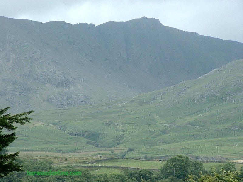
Lake District Walk  No. 39                  Total 131 miles
BT Walking Group No. 4 --- Walk led by Paul

Time Taken:  8.00 hrs   Distance:   Enjoyment:    Weather:   Cloudy & Wet
  9:45 am - 5:45 pm        10 miles          80%             Rain over mountains

Temp:     Cloud:     Rain:    Visibility:    Ground Conditions:     Wild Life:
  15oC         98%       20%       Poor            Good Underfoot        Birds, Sheep

Total AA:    Total MH:   Total LD:    Total AW:     Other:    Total Distance:
  796 mls       808 mls    1700.5 mls     131 mls       898 mls     4333.5 miles

Companions: (Derek) Colin, Bob, Will, Paul, Martin, Charley, Jim, etc.

Points of Interest:
Coniston Village          Levers Water Beck          Miners Bridge         Crowberry Haws
Stubthwaite Crag      Quarry Workings       Low Water Tarn       Old Man of Coniston
Goat's Hawse        Goat's Water         Little Arrow Moor       Disused Quarry Waterfall
Torver Beck         Torver Village        Brackenbarrow Farm        Torver Common Wood
Coniston Water         Coniston Hall Park         Bannock Stone Bridge        Lake Road
Hawkeshead Road       Coniston Village Churchyard

The Old Man of Coniston :   2633 feet (803 metres)
General: Lakeland walk with BT Walking Group. Two nights staying at Ambleside Backpackers, www.englishlakesbackpackers.co.uk Started from Coniston Village car park. All 14 of us walked up lane and track besides Levers Water Beck towards the Old Man. The views appeared for a short while as we climbed upto the old quarries, but soon became hazy as we walked into the base of the thick cloud above the Old Man. The path zig zagged upwards and became more rugged and steeper as we passed the old quarry workings and Low Water Tarn. The spots of rain became heavier and more frequent until we reached the summit where the rain was persistant and cold. Paul discussed the situation with the group as there was no sign of improvement. We all agreed to detour from the original route along the ridge to Swirl How and change to a low level walk via Goat's Water. We turned off the ridge to Goat's Hawse where we looked for shelter to have lunch. We didn't hang around, it was too cold & wet, so we soon descended to Goat's Water and onto a group photo under Goat Crag. Very rocky around the shoreline of Goat's Water, with an occational glimse of a 'tent like' blue object just under Dow Crag and at the top of the scree. Easy & pleasant walking from Goat Crag to Torver Village via an impressive waterfall at a disused quarry. Good views of cloudless mountain tops, we wished we were still on the top. A welcome pint in the Wilson Arms at Torver, then onward to Coniston Water via Torver Common Wood. The heavy black clouds had returned over the mountains again, so we had made the correct decision to detour. Easy walking along the lake via Coniston Hall Park to 'The Blue Bird Cafe' at the end of the Lake Road and the Ferry Terminal. A welcome tea & cakes before continuing to Coniston Village car park via Hawkshead Road. Visited Donald Campbell's memorial plaque and grave before heading back to another pint and the Backpackers in Ambleside. www.streepmap.co.uk start/finish Coniston 330380/497555, via Old Man Coniston 327220/497805 Hazards: Poor views from high ground due to thick black clouds on tops of mountains. Always ensure walkers had good and adequate equipment when walking on high ground. Mist or cloud is always more hazardous than expected. Paul had everything under control, as always. | |||||
 | |||||
 | |||||
 | |||||
|
|||||
 | |||||
 | |||||
 | |||||
 | |||||
 | |||||
 | |||||
 |
 |
 |
 |
 | |
| News : Formula 1 : Walking : Table Tennis : Bellringing : My Friends : My Guestbook : CV : Links | |||||
Derek Harwood: Copyright 2004 Devised: July 2004 | |||||