 |
LIFETIME of WALKS by DEREK HARWOODDerek Harwood's Walking Records If you have any queries about the pictures or discriptions please e-mail me at: derek@harwoodonline.com | ||||
 | |||||
| WILD HEAD WAY CADAIR IDRIS to ABERGYHOLWYN Sunday 17th August 2003 ...............Walk No. 563 |
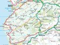 | ||||
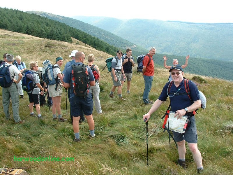
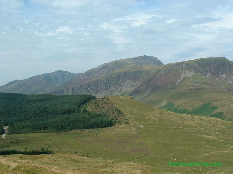
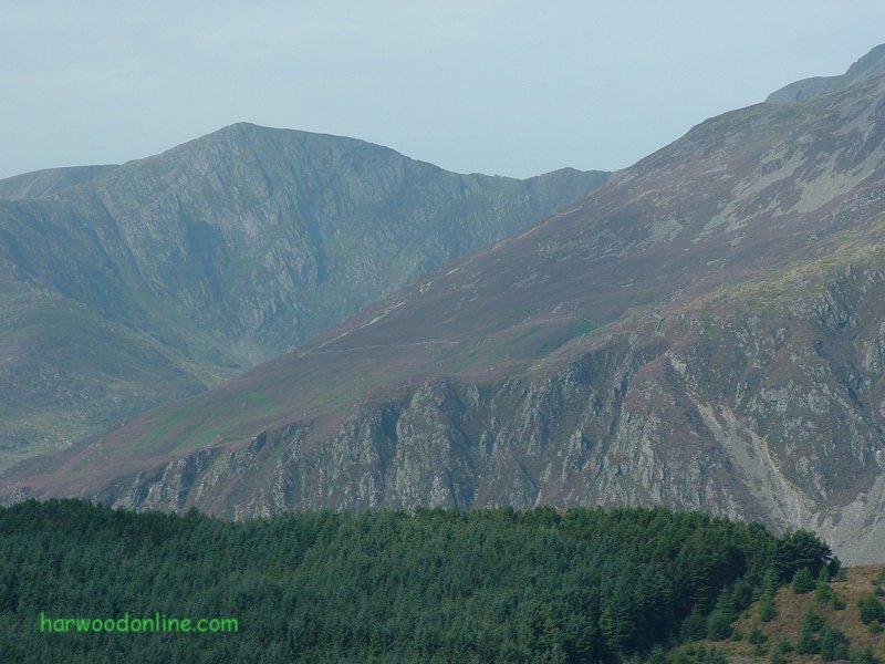
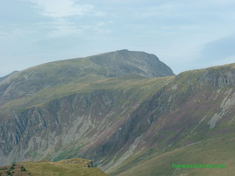
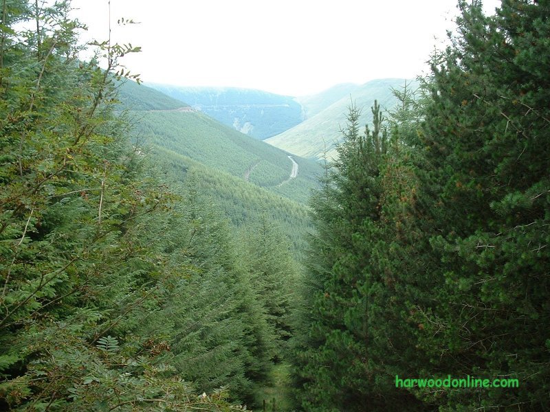
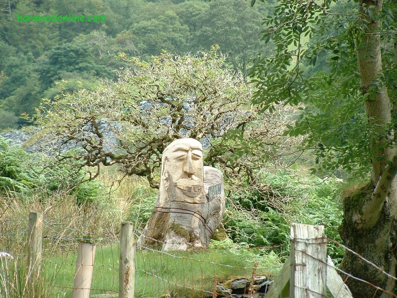
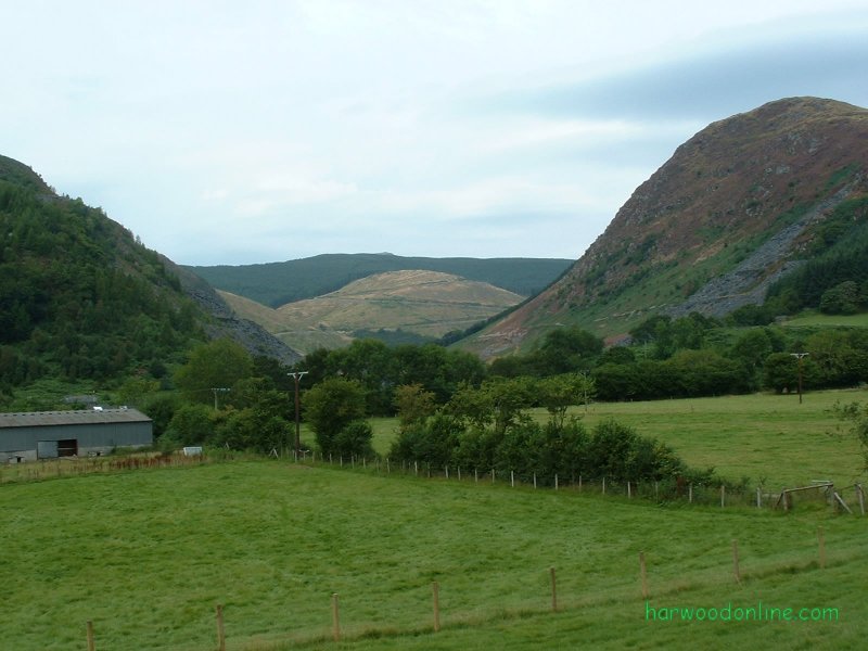
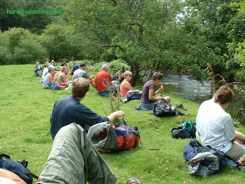
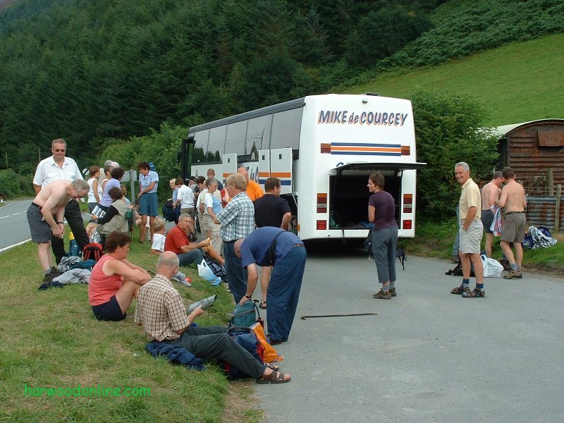
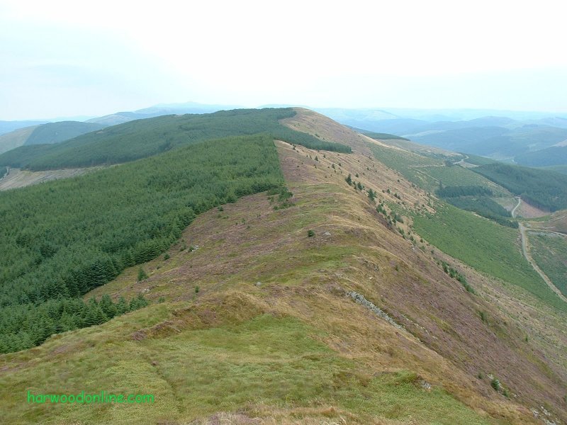
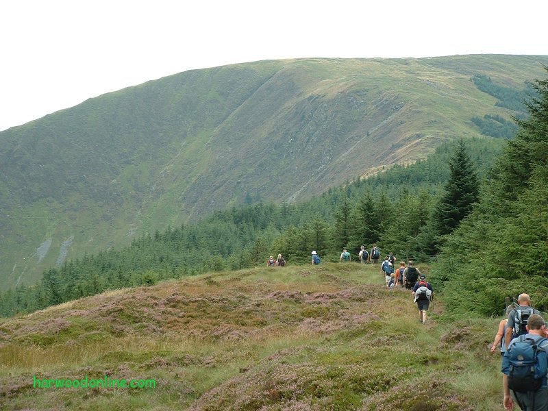
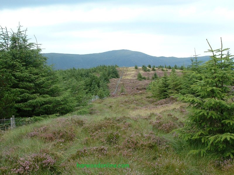
Midland Hillwalkers No. 60 Total 743.5 miles 'A' Walk led by Jack Waddle Time Taken: 7.05 hrs Distance: Enjoyment: Weather: Cloudy 10:05 am - 5:10 pm 13 miles 85% Misty, Warm & Humid Temp: Cloud: Rain: Visibility: Ground Conditions: Wild Life: 21oC 98% 0% Hazy Very Dry Mink, Sheep Total AA: Total MH: Total LD: Total AW: Other: Total Distance: 676.5 mls 743.5 mls 1674 mls 100.5 889 mls 4179 miles Companions: (Derek) Ken, John, Lynn and the contents of Trevor's bus. Points of Interest: Cadair Idris Mynydd Moel Mynydd y Waun Ffridd Newydd Cwn Ratgoed Aberllefenni Foel Crochan Afon Dulas Corris Corris Uchaf Mynydd Ty'n-y-ceunant Bryn-Eglwys Quarry Nant Gwernol Station Abergynolwyn Mynydd y Waun 1837 feet (560m) Tarren y Gesail 2189 feet (667m) General: Seventh day's walking on 'Wild Head Way'. 75.5 miles to 88.5 miles. Started from car park on A487 in the shadow of Cadair Idris at 10:05 am. Re-traced steps from last leg up road, over stile and straight upto summit of Mynydd Moel. Brisk pace maintained throughout day's walk due to lack of Trevor's time (coach driver) away from depot. Continued down track through coniferous forest, Frridd Newydd, to footbridge over Nant Ceiswyn. Cliff spotted a wood carving near bridge, see photo. Rambled through valley, complete contrast to previous hour, past Aberllefenni village and Foel Crochan to lunch at 1:00pm on the banks of Afon Dulas. As we quickly ate our sandwiches a Mink scurried past the far bank looking for food and trying not to get his feet wet. Brisk walk along valley of Afon Dulas into Abercorris where we started the steady climb on the back lane past the Hostel to Corris Uchaf. Brief walk along the main road and left up the forest zig zag track to the strip of moorland between Mynydd Ty'n-y-ceunant and Mynydd Braich-goch Forests. Wonderful views from ridge of Tarren y Gesail, with ruggedness of Cadair Idris to the north, the many forested mountains to the south and the Dovey Estuary to the west. Extremely hard going over tuffs of grass and heather to the summit and very steep descent to Pont Llaeron and the valley walk back to the coach in Abergynolwyn. Had to walk through cramp after using unknown muscles on the steep descent. Thanks once again to Bill and his leaders for another wonderful day on the hills. Special thank you to Jack who 'reckied' the 'A' walk on his own in the middle of this summer's heat wave. Hazards: Bill's strenuous 'A' walk is everyone else's very strenuous 'A' walk. Usual care required crossing moorland to avoid holes between tuffs of grass and heather when there is no obvious path. | |||||
 | |||||
 | |||||
 | |||||
|
|||||
 | |||||
 | |||||
 | |||||
 | |||||
 | |||||
 |
 |
 |
 |
 | |
| News : Formula 1 : Walking : Table Tennis : Bellringing : My Friends : My Guestbook : CV : Links | |||||
| Derek Harwood: Copyright 2003 Devised: August 2003 | |||||